Mauna Loa Eruption Update: Current Status & Guide for Visitors
Following its dramatic 2022 eruption, Mauna Loa has returned to a state of quiet. Here's our guide to understanding the 2022 lava flow, the volcano's current status, and how to stay informed.
Mauna Loa, the world's largest active volcano, captivated the world with its spectacular eruption in late 2022. After a 38-year slumber, the giant awoke, sending rivers of lava down its northern flank. Today, the volcano has returned to its quiet, background state, but the recent event provides a powerful reminder of the dynamic forces that constantly shape Hawaiʻi Island. This guide provides an update on Mauna Loa's current status, a look back at the 2022 eruption, and practical advice for visitors.
Mauna Loa's Current Status: A Return to Quiet
As of now, Mauna Loa is not erupting. The U.S. Geological Survey's Hawaiian Volcano Observatory (USGS-HVO), the authority on volcanic activity in Hawaiʻi, has designated its status as NORMAL/GREEN. This is the lowest level on the four-tier volcano alert system, indicating the volcano is in a non-eruptive, background state.
What does "background state" mean? It means that monitoring instruments are detecting normal, low levels of seismicity (earthquakes) and ground deformation. There is no evidence of magma moving towards the surface. While another eruption is certain to happen someday, there are currently no signs that one is imminent. The 2022 eruption officially ended on December 13, 2022, and the volcano has remained quiet since.
For travelers, this means there are no eruption-related hazards or closures affecting the island. You can proceed with your travel plans without concern about active lava flows from Mauna Loa. The main impact visitors will see is the vast, new rock from the 2022 flow, a stark and beautiful addition to the landscape.
A Look Back: The 2022 Mauna Loa Eruption
The most recent eruption of Mauna Loa began on the night of November 27, 2022. It started with fissures opening within Mokuʻāweoweo, the summit caldera. Within hours, the activity migrated out of the caldera and into the Northeast Rift Zone, a common pathway for Mauna Loa eruptions.
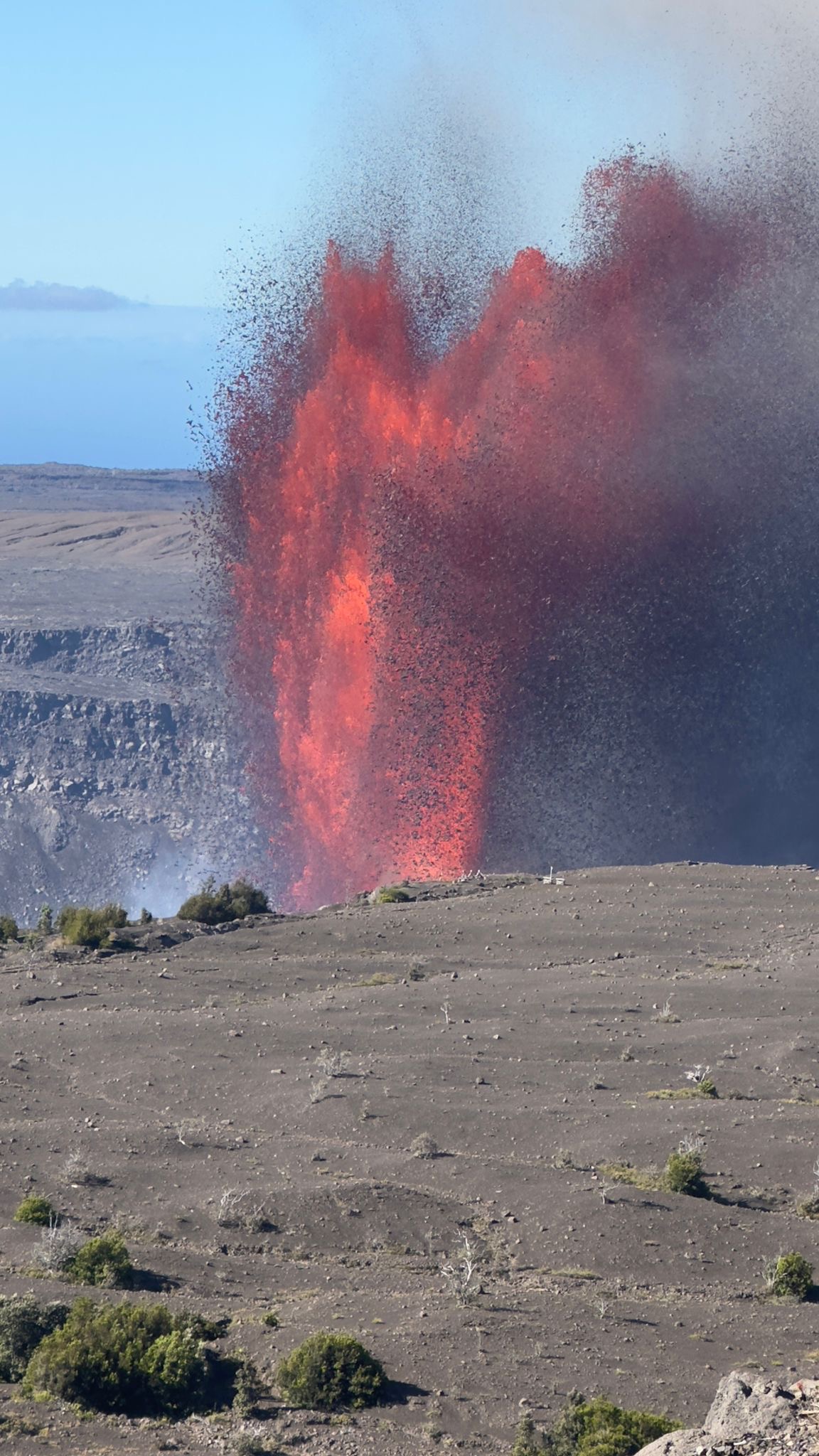
Several fissures opened, producing spectacular fountains of lava that soared hundreds of feet into the air. These fountains coalesced into a single main lava flow, dubbed "Fissure 3," which became the primary focus of the eruption. This river of molten rock moved slowly north, advancing across the vast, unpopulated lava fields on Mauna Loa's northern slope.
The flow posed a potential threat to the Daniel K. Inouye Highway (also known as Saddle Road), a critical cross-island thoroughfare. For two weeks, the world watched as the lava crept closer. It eventually crossed the access road to the Mauna Loa Observatory but stalled and stopped just 1.7 miles (2.7 km) short of the highway itself.
By December 13, 2022, the eruption had ceased. Remarkably, due to its location on the northern flank, the lava flow did not destroy any homes or major infrastructure, a testament to its predictable path and the thorough preparation by Hawaiʻi County officials.
Where You Can See the 2022 Lava Flow
The legacy of the 2022 eruption is a massive, new black lava flow that is easily visible to the public. The best and safest place to view it is from the Daniel K. Inouye Highway (Highway 200), which connects the east and west sides of the island.
As you drive along the highway, you will see a vast expanse of fresh, black ʻaʻā lava to the south. The contrast between the new, dark rock and the older, reddish-brown, and vegetated lava fields is striking. The new flow is immense, covering over 12 square miles (31 sq km) of land.
Viewing Safety
- Pull Over Safely: Only pull your vehicle over in designated scenic pullouts or on fully paved shoulders where it is safe to do so. Never stop in a travel lane.
- Be Mindful of Traffic: The Daniel K. Inouye Highway is a high-speed road with heavy traffic, including large trucks. Be extremely cautious when pulling over, exiting your vehicle, and merging back into traffic.
- Do Not Walk on the Flow: It is extremely hazardous to walk on the new lava. The surface is sharp as glass, unstable, and can have hidden cracks or hot spots. What looks like solid ground can easily crumble under your weight, leading to serious injury. It is also considered culturally disrespectful to climb on the new lava, which is seen as the physical embodiment of the volcano deity, Pele.
How Scientists Monitor Mauna Loa
The USGS Hawaiian Volcano Observatory maintains one of the most sophisticated volcano monitoring networks in the world on Mauna Loa. This allows them to detect the subtlest signs of unrest, often weeks or months before an eruption begins. This advance warning was critical for public safety during the 2022 event.
Here are some of the tools they use:
- Seismometers: A dense network of these instruments covers the volcano, detecting thousands of small earthquakes. The location, depth, and type of these earthquakes can indicate that magma is moving beneath the surface.
- GPS Stations & Tiltmeters: These precise instruments measure ground deformation. As magma accumulates in reservoirs beneath the summit, it causes the ground surface to swell or 'inflate'. The HVO network can detect changes in elevation as small as a fraction of an inch.
- Gas Sensors: Scientists monitor the type and amount of volcanic gases being released from the ground, such as sulfur dioxide (SO₂). A significant increase in SO₂ emissions is a strong indicator that magma is near the surface.
- Webcams and Satellite Imagery: Thermal and visual cameras provide 24/7 observation of the summit and rift zones, while satellites can detect thermal anomalies and large-scale ground deformation.
This constant monitoring ensures that authorities and the public will have as much warning as possible before the next eruption.
Understanding Mauna Loa's Eruption Cycles
Unlike its neighbor Kīlauea, which is known for long, sustained eruptions, Mauna Loa's personality is different. It erupts less frequently but tends to be more voluminous and powerful when it does awaken.
Since 1843, Mauna Loa has erupted 34 times, averaging one eruption every five years or so. However, this average is deceiving. Before the 38-year quiet spell preceding the 2022 event, the volcano was much more active. Its history is characterized by periods of frequent activity followed by long pauses.
Eruptions typically begin at the summit caldera, Mokuʻāweoweo, and often migrate to one of two rift zones: the Northeast Rift Zone or the Southwest Rift Zone. Flows from the Northeast Rift Zone, like the one in 2022, tend to move slower across gentle slopes, threatening Hilo or the Saddle Road area. Flows from the Southwest Rift Zone are much more dangerous to communities in the Kaʻū and South Kona districts, as the steep slopes can cause lava to reach populated areas in a matter of hours.
Planning for a Future Eruption: Safety and Respect
While Mauna Loa is quiet now, planning for a future eruption is a part of life on Hawaiʻi Island. For visitors, it's important to understand how to be a responsible and safe observer if an eruption occurs during your trip.
- Heed Official Guidance: Always follow the directions of Hawaiʻi County Civil Defense and the National Park Service. They will establish safe viewing areas and close roads as necessary. Your safety is their top priority.
- Practice Pono (Respectful) Viewing: For many Kānaka Maoli (Native Hawaiians), a volcanic eruption is a deeply sacred event—the work of Pele. Approach any viewing with reverence and respect. Stay on marked trails, do not trespass on private property, and leave no trace.
- Be Self-Sufficient: During an eruption, traffic can be intense. Always travel with a full tank of gas, extra water, snacks, and any necessary medications. Be prepared for long waits. You can find more tips in our guide to planning your Big Island itinerary.
- Air Quality: Eruptions release volcanic smog, or 'vog', which is a mix of sulfur dioxide and other particles. It can be a health hazard, especially for those with respiratory conditions. Stay informed about air quality advisories from the State of Hawaiʻi Department of Health.
Resources for Real-Time Volcano Information
When Mauna Loa shows signs of unrest again, avoid speculation on social media and turn to official sources for accurate, real-time information.
- USGS Hawaiian Volcano Observatory (HVO): The HVO website is the primary source for daily updates, alert levels, photos, and geological information.
- Hawaiʻi County Civil Defense: This agency is responsible for public safety. They issue alerts regarding road closures, evacuations, and safe viewing areas. Sign up for their alerts if you're on the island during a period of activity.
- Hawaiʻi Volcanoes National Park (NPS): The park's website provides updates on any closures or accessible viewing areas within park boundaries. A significant portion of Mauna Loa, including its summit, lies within the park.
By staying informed through these reliable sources, you can safely and respectfully experience the awesome power of Hawaiʻi's volcanoes.