Kīlauea Iki Trail Guide: A Must-Do Hike Across a Lava Lake
Hike across a solidified lava lake and through a lush native rainforest on the Kīlauea Iki Trail. Our guide covers everything you need to know for this iconic Hawaiʻi Volcanoes National Park adventure.
There are few places on Earth where you can walk across the floor of a volcanic crater that once held a lake of molten lava. The Kīlauea Iki Trail in Hawaiʻi Volcanoes National Park offers just that—a journey through a lush native rainforest, down to a cracked, steaming crater floor, and back again. It's an unforgettable experience that combines dramatic geology with the delicate beauty of a recovering ecosystem, making it one of the most rewarding hikes on the Big Island.
This isn't just a walk; it’s a trip back in time to the dramatic 1959 eruption that forever changed this landscape. Whether you're a seasoned hiker or a curious traveler, this guide will provide everything you need to know to safely and enjoyably experience the Kīlauea Iki Trail.
What is the Kīlauea Iki Trail?
Kīlauea Iki, meaning "little Kīlauea" in Hawaiian, is a pit crater located just east of the main Kīlauea caldera within Hawaiʻi Volcanoes National Park. The trail is a 4-mile (6.4 km) loop that descends from the crater rim, traverses the stark floor of the crater, and climbs back out through a vibrant rainforest. It is designated as a moderately difficult hike by the National Park Service (NPS) due to its steep and rocky sections and a 400-foot (122 m) elevation change.
The trail's main draw is the crater floor itself—a still-cooling, solidified lake of lava from a spectacular eruption in 1959. You'll walk over a landscape that was, in recent memory, a cauldron of liquid rock, witnessing steam rising from deep cracks and the first pioneering plants taking root.
The Kīlauea Iki Trail: A Complete Guide
Planning is key to enjoying this iconic hike. Here are the essential details, from where to park to which direction to go.
Trail Stats at a Glance
| Feature | Details |
|---|---|
| Distance | ~4 miles (6.4 km) loop |
| Time | 2–3 hours |
| Elevation Change | 400 feet (122 m) |
| Difficulty | Moderate |
| Trailhead | Kīlauea Iki Overlook parking lot |
| Cost | Park Entrance Fee required |
Trailhead and Parking
The primary trailhead is at the Kīlauea Iki Overlook parking lot, located on Crater Rim Drive. This lot can fill up quickly, especially between 10 a.m. and 2 p.m. If the lot is full, you have two options:
- Thurston Lava Tube (Nāhuku): There is a larger parking area about a half-mile down the road at the Thurston Lava Tube (Nāhuku). You can park here and walk along the Crater Rim Trail segment to the Kīlauea Iki Overlook to start your hike.
- Come Early or Late: Arriving before 9 a.m. or after 3 p.m. usually guarantees a parking spot at the main overlook.
Restrooms are available at the Kīlauea Iki Overlook parking area.
Which Direction to Hike?
You can hike the loop in either direction, but we strongly recommend hiking it counter-clockwise.
Starting from the Kīlauea Iki Overlook, a counter-clockwise route takes you down a series of switchbacks through the forest to the crater floor first. This gets the steepest descent over with while your legs are fresh. You then cross the crater and ascend on the other side via a more gradual, stepped slope. This direction also provides stunning, head-on views as you approach the Puʻu Puaʻi cinder cone across the crater floor. Hiking clockwise means a long, gradual descent and a very steep, rocky climb at the end.
The Hike: A Step-by-Step Journey
Following the recommended counter-clockwise route, the hike breaks down into three distinct sections.
Part 1: The Rainforest Descent
From the overlook, the trail immediately plunges into a dense, misty rainforest. The air is cool and damp, filled with the scent of wet earth and ginger. Gigantic hāpuʻu (tree ferns) arch over the trail, and towering ʻōhiʻa lehua trees form a protective canopy. Listen for the cheerful calls of the ʻapapane, a native honeycreeper with brilliant crimson feathers often seen sipping nectar from the ʻōhiʻa blossoms.
The trail here consists of rocky, root-bound switchbacks as it zig-zags 400 feet down to the crater floor. Take your time, watch your footing, and enjoy the transition from this lush, living world to the starkly different one that awaits below.
Part 2: Across the Crater Floor
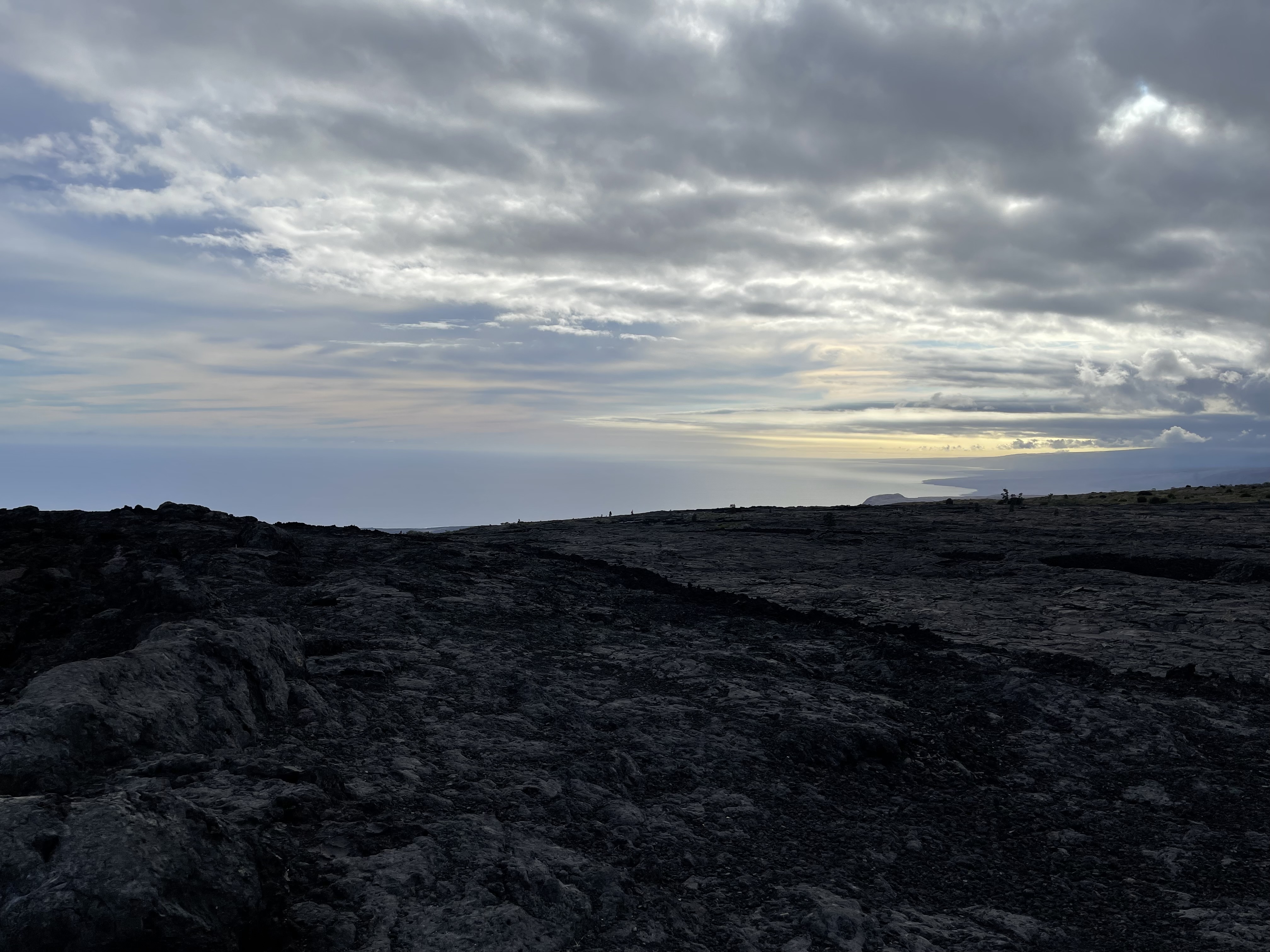
The transition from forest to crater floor is abrupt and breathtaking. You step out from under the trees onto a vast, undulating field of black lava. The path is marked by ahu (stacked stones) that guide you across the crater. The ground is uneven and cracked, a testament to the immense forces that shaped it. In some areas, you can see the "bathtub ring" on the crater walls, marking the high point of the lava lake during the 1959 eruption.
As you walk, look for steam vents where rainwater has seeped deep into the rock and is boiled by the residual heat below. You can often feel the warmth radiating from the ground. While the crater floor may seem barren, look closely. Small ʻōhiʻa saplings and ferns are beginning to colonize the cracks, pioneers in this slow process of regeneration.
The halfway point is marked by the imposing sight of Puʻu Puaʻi ("gushing hill"), the massive cinder cone formed during the eruption. This is where a fissure opened up and sent fountains of lava soaring into the air.
Part 3: The Ascent and Rim Walk
After crossing the nearly 1-mile expanse of the crater floor, the trail begins its ascent back to the rim. The climb on the eastern side is more gradual than the initial descent, often involving rock steps built into the slope. You'll quickly re-enter the forest, gaining elevation until you reach the crater rim near the Thurston Lava Tube (Nāhuku) parking area.
From here, the final leg of the journey is an easy and scenic walk along the paved Crater Rim Trail. This section offers spectacular panoramic views back down into Kīlauea Iki, giving you a new perspective on the ground you just covered. The final half-mile leads you directly back to the Kīlauea Iki Overlook parking lot where you started.
Geology of Kīlauea Iki: The 1959 Eruption
What makes this hike so special is its direct connection to the famous 1959 Kīlauea Iki eruption. According to the U.S. Geological Survey (USGS), on November 14, 1959, a fissure tore open on the southern wall of the crater, unleashing a torrent of lava. Over the next five weeks, 17 episodes of lava fountaining occurred, with some jets of molten rock reaching a staggering 1,900 feet (580 m) high—among the tallest ever recorded.
These fountains filled the crater with a churning lake of lava that reached a depth of over 400 feet. When the eruption ceased, the lava began to cool and solidify from the top down, forming a crust. Today, while the surface is solid, the core of that lava lake is still cooling. This remarkable event is a key part of the story of the Big Island volcano, and walking the trail is the best way to comprehend its scale.
How to Prepare for Your Hike
Proper preparation is essential for a safe and enjoyable hike. The weather at Kīlauea's summit can change in an instant.
What to Wear and Bring
- Sturdy Footwear: Closed-toe hiking shoes or boots with good ankle support are a must. The crater floor is very uneven.
- Water: Bring at least 2 liters of water per person. There is no water available on the trail.
- Layers: Dress in layers. It can be cool and misty in the forest but hot and sunny on the exposed crater floor. A rain jacket is always a good idea.
- Sun Protection: A hat, sunglasses, and sunscreen are crucial for the crater crossing.
- Snacks: Pack some energy-boosting snacks.
- Camera: The photo opportunities are endless.
Safety and Park Regulations
- Stay on the Trail: The ahu (rock cairns) mark the path for a reason. Off-trail terrain is unstable and fragile. Do not approach steam vents, as the ground can be thin and the steam is scalding.
- Check Park Conditions: Before you go, always check the official Hawaiʻi Volcanoes National Park website for any trail closures or advisories related to weather or volcanic activity.
- Volcanic Fumes (Vog): The air quality can sometimes be poor due to volcanic gas or vog. Visitors with respiratory issues should be cautious and check conditions before hiking.
- Leave No Trace: Pack out everything you pack in.
Best Time to Hike
The Kīlauea Iki Trail is accessible year-round. The best time of day to hike is early in the morning (before 9 a.m.) to avoid the midday heat on the crater floor and the biggest crowds. An afternoon hike (after 3 p.m.) is also a good option for cooler temperatures.
While rain is possible any day of the year at the summit, the rainiest months are typically November through March. A misty, rainy day can add to the mysterious atmosphere, but heavy rain can make the rocky sections slippery.