A Complete Guide to Driving the Chain of Craters Road
This stunning drive descends 3,700 feet from the summit of Kīlauea to the sea, offering a front-row seat to the raw power of creation and destruction.
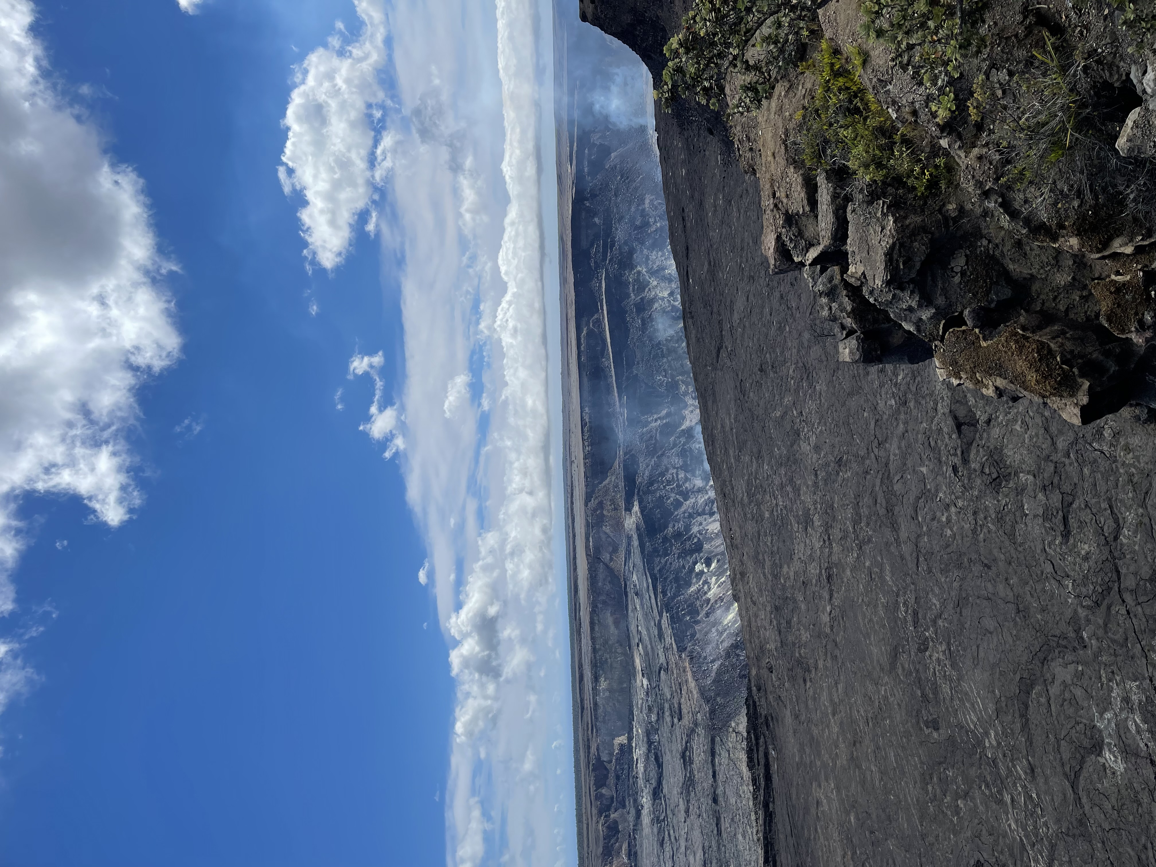
The Chain of Craters Road is one of the most dramatic and unforgettable drives in all of Hawaiʻi. Winding its way from the summit of Kīlauea down to the Puna coast, this 19-mile road descends 3,700 feet through a landscape continually reshaped by volcanic activity. This isn't just a scenic drive; it's a journey through geological time, where every pullout reveals another chapter in the story of a living volcano.
Your drive will take you past stark pit craters, through seas of once-molten rock, and alongside ancient Hawaiian petroglyphs, culminating at a rugged sea arch carved by the relentless Pacific. Planning is key, as there are no services along the way. This guide will help you make the most of your adventure down the Chain of Craters Road.
Getting Started: Before You Descend
The Chain of Craters Road is located entirely within Hawaiʻi Volcanoes National Park. Access begins off Crater Rim Drive, a few miles past the main park entrance.
Before you even begin the drive, remember this mantra: There is no food, water, or gasoline available on the Chain of Craters Road. The nearest services are in the small town of Volcano, just outside the park entrance.
Here’s your pre-drive checklist:
- Park Pass: You'll need a valid Hawaiʻi Volcanoes National Park entrance pass. You can purchase one at the entrance station. The pass is valid for seven days.
- Full Tank of Gas: The round trip is only about 38 miles, but you'll want a full tank for peace of mind, especially if you plan on exploring other parts of the park.
- Supplies: Bring plenty of water (at least one liter per person), snacks or a picnic lunch, sunscreen, hats, and sunglasses. The coastal end of the road can be hot, sunny, and windy.
- Gear: Wear sturdy, closed-toe shoes. You'll be walking on uneven, sharp lava rock (pāhoehoe and ʻaʻā) at nearly every stop. Also, pack rain gear; weather can change in an instant.
- Check Conditions: Always check the official NPS website for Hawaiʻi Volcanoes National Park for any road closures, advisories, or eruption updates before you go. Volcanic activity can change conditions daily.
The Descent: Must-See Stops Along the Way
The drive itself can take about 45 minutes one-way without stopping, but the whole point is to stop. Plan for at least 3-4 hours to properly explore. The road is well-paved and suitable for all vehicles. The speed limit is low, so take your time and use the frequent pullouts to let faster traffic pass and to soak in the views.
Lua Manu Crater (Mile 3.5)
Just a short drive from the turnoff, your first stop is Lua Manu. A quick walk from the parking area leads you to the rim of a deep pit crater that formed around 200 years ago. Its steep walls offer a dramatic preview of the volcanic features to come. This is a great, quick stop to stretch your legs and grasp the scale of these collapse features.
Puhimau Crater (Mile 4)
Don't be fooled by the unassuming, forested look of Puhimau. This large, oval-shaped crater is notable for its hydrothermal activity. On cool, wet mornings, you may see steam rising from the crater floor and walls—a potent reminder of the magma chamber simmering deep beneath your feet. According to the USGS, this heat is why the area remains unforested.
Mauna Ulu Trailhead (Mile 9.5)
This is a major stop and a fantastic hiking destination. Mauna Ulu ('Growing Mountain') was the site of a major eruption from 1969 to 1974 that profoundly reshaped this area. A one-mile round trip hike leads you to the top of the Mauna Ulu shield for incredible views of the surrounding landscape, including the now-inactive Puʻu ʻŌʻō cinder cone in the distance. The trail is marked by ahu (cairns) and can be hot and exposed.
Kealakomo Overlook (Mile 12)
The name Kealakomo means 'the entering path,' and this stunning viewpoint is where the grand scale of the landscape truly reveals itself. From here, the road begins its steep descent to the coast. You can see the vast, black lava plains stretching for miles to the deep blue Pacific. It's a perfect spot for photos and to contemplate the immense lava flows of the past. A picnic table makes this a great spot for a snack break.
A Walk Into the Past: The Puʻu Loa Petroglyphs
Located near the end of the road (Mile 16.5), the Puʻu Loa Petroglyphs are one of the most culturally significant sites in the park and a must-do for any visitor. Puʻu Loa, meaning 'Hill of Long Life,' is home to the largest known field of petroglyphs (kīpuka pōhaku) in the State of Hawaiʻi, with over 23,000 images carved into the hardened lava.
The symbols include geometric motifs, human figures, and numerous piko (umbilical cord) holes, where the cords of newborn infants were placed to ensure a long and prosperous life.
A 1.5-mile round-trip boardwalk and trail lead to a viewing area. The walk itself is across an exposed pāhoehoe lava field and can be very hot. Please be respectful of this sacred site by staying on the designated boardwalk and trail at all times. Touching the petroglyphs can damage them, and wandering off-trail can harm undiscovered carvings.
The Coast: Hōlei Sea Arch and the Terminus
The road ends at Mile 19, where lava flows from the Puʻu ʻŌʻō eruption covered it in 1986 and subsequent years. Here you'll find the majestic Hōlei Sea Arch. This 90-foot-high arch was carved from a 600-year-old lava flow by the powerful surf. It's a beautiful, dynamic feature, but be aware that it is temporary—the ocean that created it will eventually destroy it. A viewing area provides a safe place to admire the arch.
This terminus is the end of the line for vehicles. It features a paved parking area and public restrooms. While there is sometimes a temporary ranger station here, don't count on it being staffed. This is also a popular spot for watching the sunset, but be prepared for a long, dark drive back up the mountain.
Can You See Lava? It's the question on everyone's mind. Generally, no, you cannot see active, flowing lava from the Chain of Craters Road. The last major eruption that was accessible from this area ended in 2018. For current eruption status and designated viewing areas (which are almost always at the Kīlauea summit), the NPS website is your only reliable source.
Driving the Chain of Craters Road is an essential Big Island experience. It offers a tangible connection to the forces that shape this land, providing a deeper understanding of Hawaiʻi's volatile, beautiful heart. It's a key part of planning any comprehensive visit, which we can help with at High End Hawaiʻi.
Related Reading: